
Agra is India’s most visited heritage city and among its most transit-demanding — millions of tourists, domestic pilgrims, and regional travelers passing through annually alongside the city’s own working population. Idgah Bus Stand is Agra’s biggest bus terminal, positioned in the Idgah Colony locality in the city’s southwestern zone. Its name derives from the Idgah — the open-air enclosure used for Eid prayers — that historically occupied this part of Agra, a naming lineage that connects the bus stand to centuries of civic geography in this Mughal heartland city.
UPSRTC operates the full spectrum of its service categories from Idgah — hi-tech, deluxe, semi-deluxe, and ordinary buses connecting Agra to Delhi, Jaipur, Mathura, Vrindavan, Gwalior, Lucknow, Kanpur, Bharatpur, and dozens of towns across western Uttar Pradesh and neighboring Rajasthan and Madhya Pradesh. The stand’s co-location with the Idgah Railway Station — which serves approximately 75,000 passengers daily — and its proximity to Agra Cantt, the city’s main railway station on the Delhi-Chennai and Delhi-Mumbai main lines, gives this terminal an unusually strong multimodal character for a secondary-city bus terminal.
Private intercity operators have also established boarding points in this zone, making it the city’s primary concentration of both public and private long-distance bus activity.
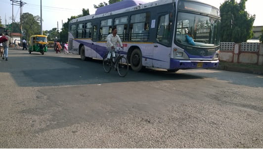
Overview Table
| Detail | Information |
| Name | Idgah Bus Stand |
| Location | Kheria Mode Road, Purani Idgah Colony, Idgah Colony, Agra, Uttar Pradesh — 282001 |
| Operated By | UPSRTC (Primary); Private Operators |
| Status | Largest bus station in Agra |
| Bus Service Types | Hi-Tech, Deluxe, Semi-Deluxe, Ordinary |
| Key Routes | Delhi, Jaipur, Mathura, Vrindavan, Gwalior, Lucknow, Kanpur, Bharatpur, Aligarh |
| Nearest Railway Station | Idgah Railway Station (IDH) — Approx. 1 km |
| Nearest Main Railway Station | Agra Cantonment (main station) — Approx. 1–2 km southwest |
| Distance from Taj Mahal | Approx. 4–5 km |
| Distance from Agra Fort | Approx. 3 km northeast |
| Distance from Delhi | Approx. 200 km via Yamuna Expressway |
| Distance from Jaipur | Approx. 235 km via NH-21 |
| Distance from Mathura | Approx. 58 km via NH-19 |
| Metro Connectivity | Agra Metro under construction — stations planned near city zones |
| Governing Authority | UPSRTC, Agra District Administration |
| Airport | Agra Airport (Pandit Deen Dayal Upadhyay) — Approx. 8–10 km |
Location
The bus stand occupies the Purani Idgah Colony area in Agra’s southwestern zone — the part of the city historically associated with the military cantonment economy and the commercial activity that accumulated around the railway corridor. Kheria Mode Road on which the stand sits is one of Agra’s important southern arterials, connecting the cantonment area to the city’s main commercial zones and linking southward toward the highways. The proximity to both Idgah railway station and Agra Cantt gives travelers arriving at this bus stand exceptional onward rail options.
Directions
From the Taj Mahal, travel southwestward via the city road network approximately 4 to 5 kilometres, 15 to 25 minutes by auto-rickshaw. From Agra Fort, travel approximately 3 kilometres southward, 10 to 20 minutes. From Delhi via the Yamuna Expressway, approach Agra from the northeastern direction and navigate toward Idgah Colony from the city’s main approach arterials — approximately 200 kilometres from Delhi, 2 to 2.5 hours on the expressway. From Jaipur, travel eastward via NH-21 approximately 235 kilometres, 3 to 4 hours.
Metro and Public Transport Connectivity
Agra Metro is under construction, with Phase 1 covering two corridors within the city. Once operational, metro stations in the city’s key zones will improve connectivity toward the bus stand area. Agra Cantt railway station — one of India’s important junctions on the Delhi-Chennai and Delhi-Mumbai main lines — is within approximately 1 to 2 kilometres of the bus stand, making rail-to-bus transfer practical. City autos and e-rickshaws handle the intra-Agra movement from the bus stand to the heritage zone.
Nearby Areas
Taj Mahal: The world’s most iconic monument is 4 to 5 kilometres from the bus stand — the city’s entire tourism economy radiates from this proximity, making the Idgah zone a genuinely central location for visitors who arrive by long-distance bus rather than rail. Agra Fort: The massive UNESCO World Heritage Mughal fortification along the Yamuna riverfront is accessible by auto-rickshaw from the stand. Sadar Bazaar: Agra’s most important commercial market street is within the bus stand’s surrounding zone, offering the shopping, restaurant, and hotel facilities that long-distance bus travelers need on arrival.
Frequently Asked Questions (FAQs)
Q1. Where is Idgah Bus Stand in Agra?
Kheria Mode Road, Purani Idgah Colony, Agra, Uttar Pradesh — approximately 4 to 5 km from the Taj Mahal and 1 to 2 km from Agra Cantonment railway station.
Q2. Which operator runs buses from Idgah Bus Stand?
UPSRTC is the primary operator, running hi-tech, deluxe, semi-deluxe, and ordinary services. Private operators also run intercity services from this zone.
Q3. How far is Idgah Bus Stand from Delhi?
Approximately 200 km via the Yamuna Expressway, taking 2 to 2.5 hours.
Q4. What railway stations are near Idgah Bus Stand?
Idgah Railway Station (about 1 km) and Agra Cantonment (about 1 to 2 km) are both within close proximity.
Q5. What major routes are served from Idgah Bus Stand Agra?
Delhi, Jaipur, Mathura, Vrindavan, Gwalior, Lucknow, Kanpur, and Bharatpur are among the major destinations.