Satellite is the address that tells you something specific about Ahmedabad’s social geography. The western suburb developed from the 1980s onward as the city’s expanding professional and business class moved westward from the old city and riverfront zones, building apartment complexes and commercial establishments along the SG Highway and Satellite Road corridors that have since become among Ahmedabad’s most commercially important streets. ISKCON Temple, DLF and Kenilworth malls, the residential societies with names like Prernatirth Residency and Utsav Arcade — these are the coordinates of a zone whose residents belong to the city’s earning professional and business demographic.
The Satellite Bus Station or bus stop zone in Ahmedabad’s Satellite locality is not a GSRTC intercity terminal but rather a significant AMTS and BRTS city transit node — the bus stop and chartered service point on Satellite Road near the Ramdevnagar BRTS and the associated AMTS routes that serve the western residential belt’s daily mobility needs. The Satellite Gate and Ramdevnagar BRTS stops are the primary formal BRTS stops in this zone, served by AMTS routes 151/3, 1D, 205, 50, 8D, 138/1, 15U, and 49 among others. GSRTC intercity departures for long-distance travel are accessed from Gitamandir, but for city-level connectivity the Satellite zone’s AMTS and BRTS network is comprehensive.
Rajiv Nagar Metro Station on Line 2 (Blue Line) is approximately 14 minutes walk — closer metro access exists at the Jivraj Park station which is within 7 minutes walk of parts of the Satellite zone.
| Detail | Information |
| Name | Satellite Bus Station / Satellite Road Bus Stops |
| Location | Satellite Road / Ramdevnagar area, Satellite, Ahmedabad, Gujarat — 380015 |
| Operated By | AMTS (Ahmedabad Municipal Transport Service); Ahmedabad BRTS (Janmarg) |
| Primary BRTS Stops | Ramdevnagar BRTS, Satellite Gate, Jodhpur Char Rasta BRTS |
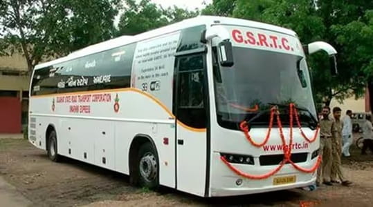
| Chartered Bus Service | B/4, Satellite, Satellite Road, Ahmedabad — 380015 |
| Key AMTS Routes | 151/3, 1D, 205, 50, 8D, 12D, 45, 49, 201 |
| First AMTS Bus | 6:33 AM (Route 151 at Satellite Gate) |
| Last AMTS Bus | 10:08 PM (Route 50 at Satellite Gate) |
| Nearest Metro Station | Jivraj Park — Ahmedabad Metro Line 1/2 — Approx. 7–8 min walk |
| Nearest GSRTC Terminal | Ahmedabad Gita Mandir Bus Station — Approx. 8–10 km |
| Distance from Ahmedabad Junction (Kalupur) | Approx. 7–8 km |
| Distance from Sardar Patel Airport | Approx. 5–8 km |
| Key Landmarks | ISKCON Temple, DLF Mall, Star Bazaar, Jodhpur Cross Road |
| Governing Authority | AMTS, Ahmedabad Janmarg Limited (BRTS) |
Location
The Satellite bus stop zone runs along Satellite Road in the Satellite locality of western Ahmedabad — between the Ramdevnagar BRTS stop near the ISKCON complex to the north and the Jodhpur Char Rasta BRTS stop toward the south. The Satellite Gate stop is the most central reference point within this corridor. The surrounding commercial landscape is distinctly western Ahmedabad — premium residential societies, branded retail, multiplex cinemas, and the professional services establishments that serve an affluent residential catchment.
Directions
From Ahmedabad Junction (Kalupur): Travel westward via the city arterials approximately 7 to 8 kilometres, 25 to 35 minutes by AMTS bus or metro.
From Jivraj Park Metro Station: Walk approximately 7 to 8 minutes eastward toward the Satellite Gate BRTS stop.
From Ahmedabad Airport: Travel southward and eastward approximately 5 to 8 kilometres, 15 to 25 minutes by cab or auto-rickshaw.
From Gita Mandir Bus Station: Take AMTS westward approximately 8 to 10 kilometres, 25 to 40 minutes through the city’s east-west transit corridor.
Connectivity
Jivraj Park Metro Station on Ahmedabad Metro’s Blue Line (Line 2, east-west corridor) is the most practically important transit connection for the Satellite zone — the metro connects westward toward Thaltej and eastward toward APMC, Vastrapur, and ultimately the Ahmedabad BRTS network. The Ahmedabad BRTS Janmarg system’s dedicated corridors pass through the Satellite zone with the specific operational efficiency that dedicated bus rapid transit achieves when the corridor design actually prevents private vehicle encroachment. AMTS city buses supplement with higher-frequency service on the Satellite Road corridor.
Nearby Areas
ISKCON Ahmedabad: The large BAPS-adjacent but ISKCON-operated temple complex near the Ramdevnagar end of the Satellite zone draws significant religious visitor traffic that uses the BRTS and AMTS network. Jodhpur Cross Road: One of western Ahmedabad’s most commercially active intersections is within the Satellite bus zone’s catchment, anchored by retail, restaurants, and professional service offices. SG Highway (Sardar Patel Highway): The premium commercial corridor of western Ahmedabad runs roughly parallel to the Satellite Road zone and its luxury hotels, corporate offices, and premium residential towers are accessible from the Satellite bus stops.
Frequently Asked Questions (FAQs)
Q1. Where is Satellite Bus Station in Ahmedabad?
A: Satellite Road, western Ahmedabad — the primary BRTS stops are Ramdevnagar BRTS, Satellite Gate, and Jodhpur Char Rasta BRTS, serving the Satellite residential and commercial zone.
Q2. Is Satellite Bus Station an intercity terminal?
A: No — it is a city-level AMTS and BRTS transit zone. For intercity GSRTC buses, travelers use Gita Mandir Bus Station approximately 8 to 10 km away.
Q3. Which metro station serves Satellite Bus Station area?
A: Jivraj Park Station on Ahmedabad Metro Line 2 — approximately 7 to 8 minutes walk from the Satellite Gate BRTS stop.
Q4. What AMTS routes serve the Satellite bus zone?
A: Routes 151/3, 1D, 205, 50, 8D, 12D, 45, 49, and 201 are among the major AMTS services through the Satellite corridor.
Q5. How far is Satellite Bus Station from Ahmedabad Airport?
A: Approximately 5 to 8 km — one of the closer major residential zones to Sardar Vallabhbhai Patel International Airport in Ahmedabad.